Supports Barometer,E-compass,Fishing evaluation function and ANT+ compatible Hear Rate monitor


Supports Barometer,E-compass,Fishing evaluation function and ANT+ compatible Hear Rate monitor
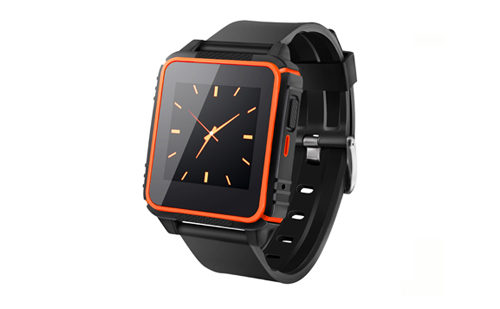
MG350 Land measurement GPS is a simple and nice personal outdoor GPS device,It equipped with 2.2-inch TFT diaplay,
Barometer,G-sensor and E-compass,and also supports ANT+ compatible Heart rate Monitor,With its
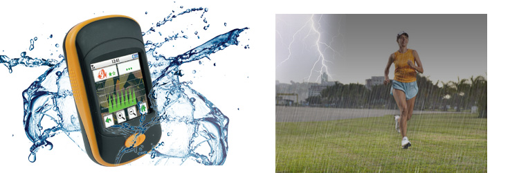
compactdesign and light weight,It is suitable for many conditions,such as riding,climbing,running, fishing,etc.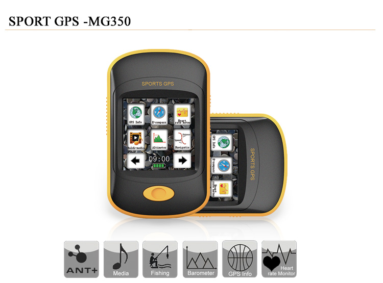
IPX-7 Waterproof
![]()
The GPS can withstand accidental immersion in one meter of water for up to 30 minutes
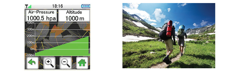
Barometer
![]()
Provide barometer pressure value,height etc.
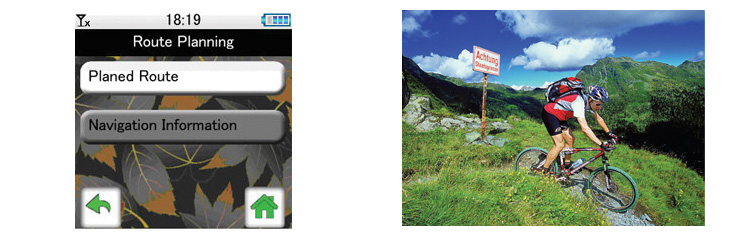
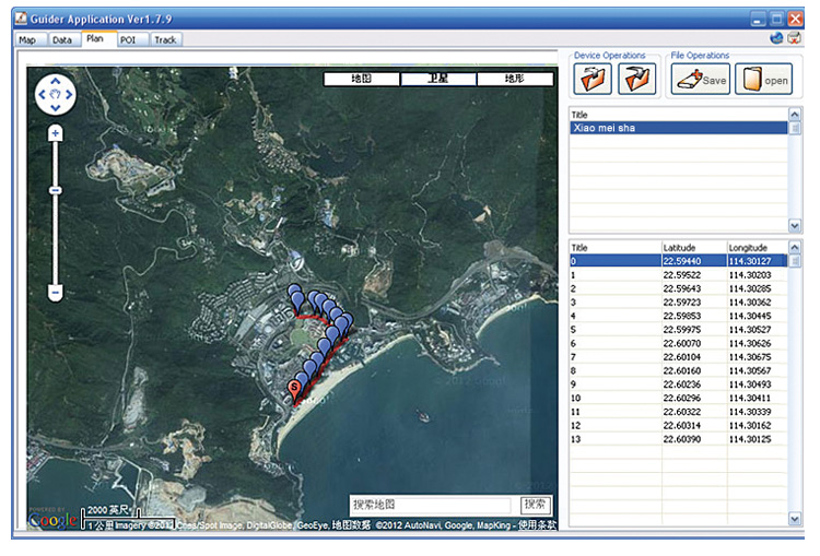
Route Planning
![]()
You can plan your route by the APP in a computer,and upload it to your personal land measurement GPS.Supported
file format:RTE,KML,GPX.
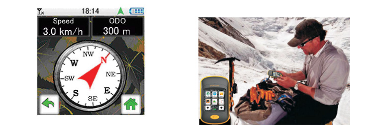
E-compass
![]()
Use E-compass to avoid getting lost when the GPS signal I not good in harsh environments.
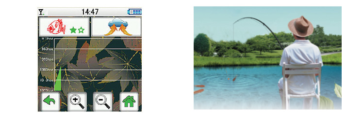
Fishing evaluation function
![]()
Provide weather forecast,Pressure system,fishing probability and 24-hours pressure chnge chart,so
that you always grasp the trend of changes in air pressure,adjust the fishing location and waer depth,
and improve the chances of fishing.
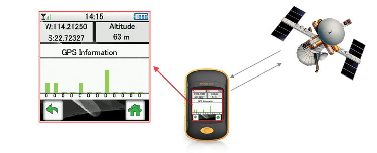
GPS function
![]()
●GPS Accuracy:4-10meters in normal GPS mode.
●Altitude measurement
●Path Guiding:simulated route navigation
●Speed/Elapsed tim/Distance etc.
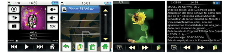
Media function
![]()
●MP3 and MP4 playback
●Photo playback
●Support e-book
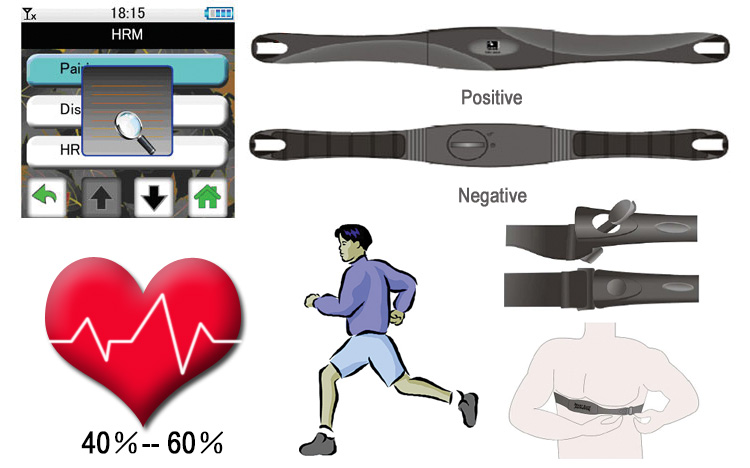
Support ANT+ compatible Heart Rate monitor
![]()
Connect to ANT+ 2.4GHz compatible heart rate monitor,you can see
●Training instant information display
●Real-time heart rate shows
●Training interval indication(user can choose different training interval)
●Alert when HR isn’t in specified zone
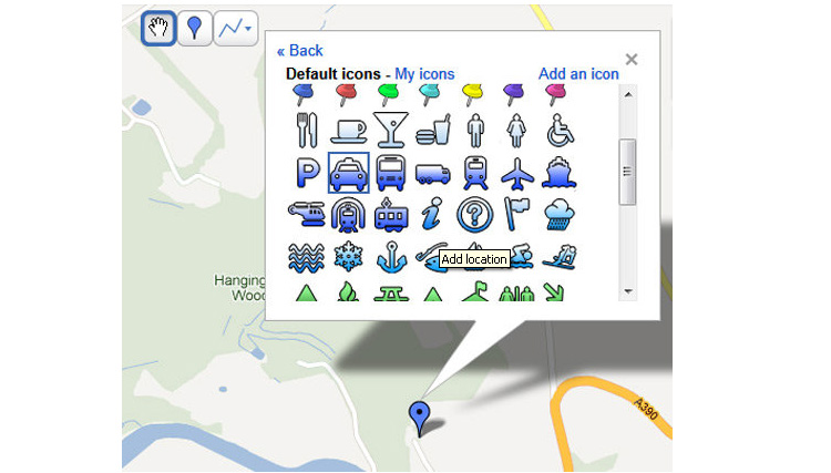
Sport analysis by the APP
You can plan a route through Google map.(maximum 50 routes with each route maximum 50waypoints)
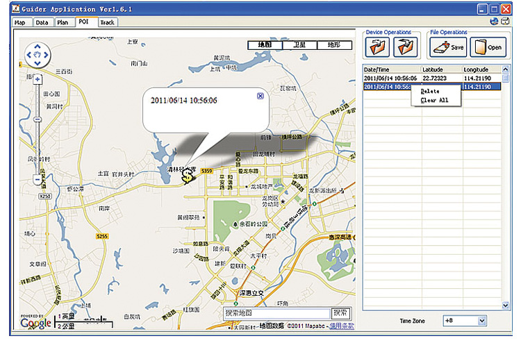
POI is for managing the marked POIs in the route.POIs can be downloaded from the land meaurement GPS
and saved into files for backup.
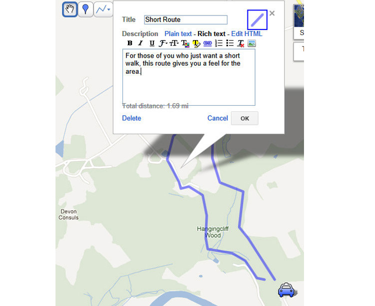
Download tracks from the land measurement GPS,Click one route of the track and it will show date,start time,end
time,duration,total distance,total waypoints of the route.
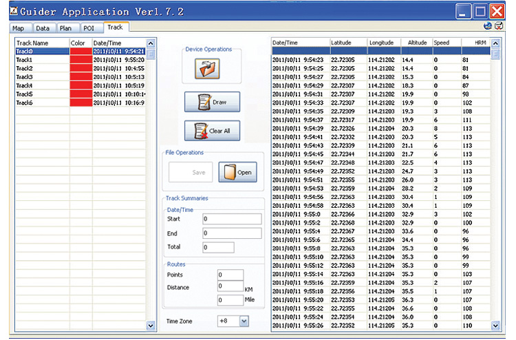
Share your sports tracks with your friends at some sports websites

| Display | 2.2″(320*320 pixels)TFT Display Screen with TP |
| Positioning time | cold start:<55s;warm start:<40s;hot start:<1s |
| POI/Waypoints/Tracking Points | POI:50;Waypoints:2500;Tracking Points:25000/Lines |
| Display data: | Speed,altitue,longitude,latitude and other GPS information can be pbtained by the APP |
| Navigation files format | support KML,RTE format files |
| Generating files format | generate KML, TRK format files |
| Path guiding | simulated route navigation |
| Fishing | provide fishing the best time |
| Data management | AP software management GPS,HRM data |
| Barometer | provide barometer pressure value,height etc |
| HRM(optional) | support ANT2.4GHz heart rate monitor |
| MP3/MP4 | support MP3/MP4 playback |
| Flash Menory | 4GB |
| Power supply | Li-polymer battery,operation time 10 hours(1600mAh) |
| Waterproof | IPX-6 |
| Size | 94(L)x57(W)x22.5(D)mm |
| operating temperature | -10°C~60°C |
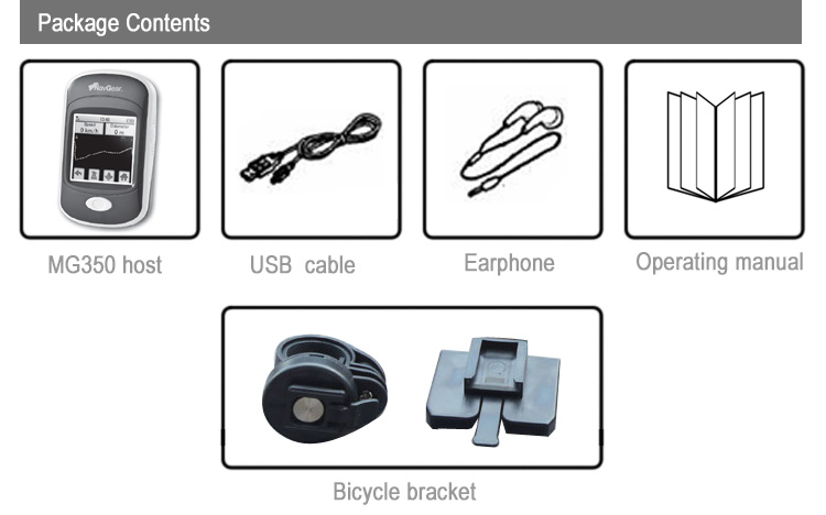
| Standard equipment | Mg350 land measurement GPS,Manual,Bicycle bracket,USB cable,earphone |
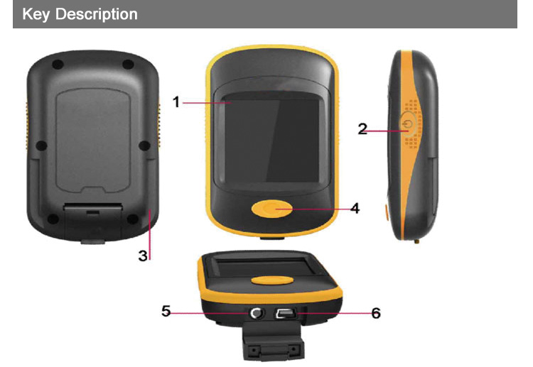
1.Display 2.On/Off 3.Bicycle bracket interface 4.Menu
5.Headphone jack 6.Mini USB interface 7.Reset:Press the switch key and menu key
![]()
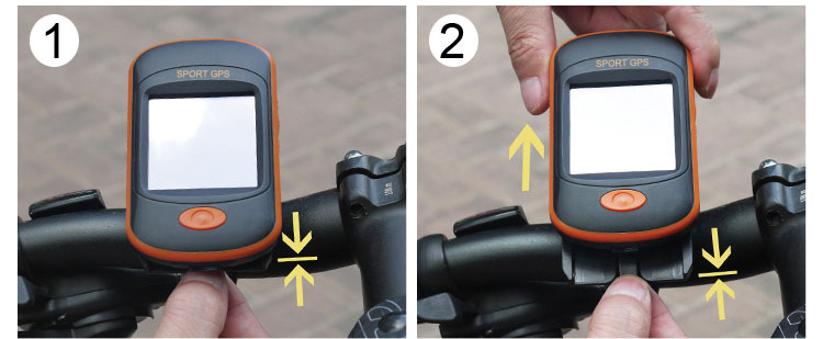
Please follow the steps as below to install/uninstall the land measurement GPS to your bike
Install steps:
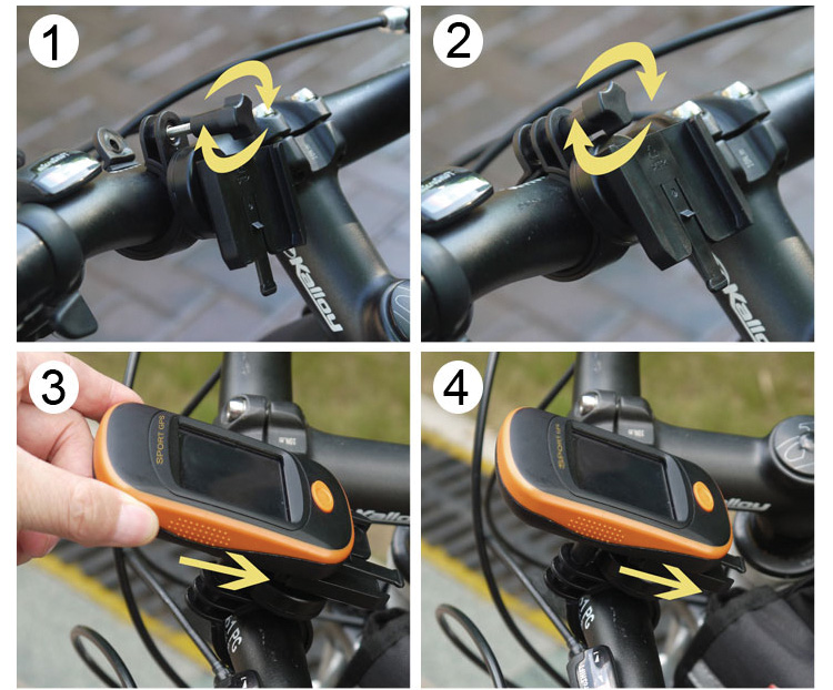
Unstall steps:
| Size | Small, Medium, Large, X-Large |
|---|---|
| Colors | Comes in Earth Tone Grey |
| Material | CoolMax Cotton/Polyester Blend |
| Other | Printed Internal Label Detail |
| Weight | N/A |
You must be logged in to post a review.
Reviews
There are no reviews yet.